Revelstoke’s Marquee Alpine Mountain Bike Trail
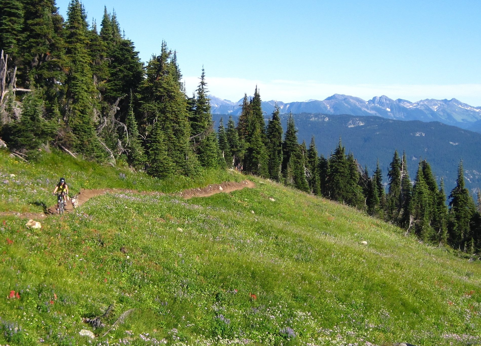
Welcome to Revelstoke’s marquee alpine mountain bike trail, a purpose-built trail constructed by bikers for bikers. A truly great trail with magnificent views, abundant wildflowers, and excellent fast flowy riding. The trail climbs from a cutblock up through very impressive mountain hemlock sub-alpine forest and into the alpine meadows, cresting on a rolling ridge with views in all directions. You reach the high point at the 10 km mark after climbing 700 meters then the trail dips down for another 2 km, with stunning mountain views, to a small lake. A great spot for some lunch before you head back up and out.
Access
The access is 2 wheel drive accessible, but we recommend a high clearance 2 wheel drive vehicle minimum since the road can be fairly rough. From Revelstoke head west on the Trans-Canada highway across the Columbia River, at the highway 23 junction (traffic lights here) turn right or north onto Westside Road, Drive up Westside Road for about 8km/10 minutes, to a point where it turns into an odd 4 way junction leading onto gravel logging roads. To this point, don’t be fooled by the Frisby Ridge snowmobile signs, some point the right way, some don’t! Turn left on the Frisby Ridge Road, there is a sign here, and also a tall cedar post with a sign indicating “Rec Trail” with an arrow and bike symbol. All subsequent junctions are signed, and will lead you 9km up the gravel road to the parking area (trailhead kiosk with map here) and great views down the valley over Revelstoke. Specifically, from the start of the gravel road the junctions are at 0.7km go left, 1.6km go right, 4km go left, 5,8km go left, 6.2km go right, 8.2km go left, 9km go left to the large parking area with kiosk and outhouse. Riding from town to the trailhead adds 2+ hours and 800m/2500ft. of climbing.
The Ride
From the trailhead (1330m) follow the trail as it climbs 700m gently but steadily for about 10 kms to the high point (2030m). There are 2 viewpoints, one at 5.5 to the east looking over Revy, and another at 7.2km to the west look over the Monashees, if you wish to take a break and make a short walk. Continue from the high point of the trail, if you wish, descending for another 2 kms to a small alpine lake and the end of the trail. Head back up and over and enjoy the long flowy cruise back down, you deserve it! In 2013 a bypass trail was added on the west side of the high point (starting about 1 km from the top) so you can make a partial loop or avoid riding up to the high point on the way out or back from the lake.
Note that there are many blind corners and uphill riders have the right of way, descend with caution!
Safety First
A few points to make your day more enjoyable and safe:
- This trail is in a caribou closure area and is not open until July 15 of each year.
- This is a remote alpine trail so come prepared for: flat tires, bike problems and possible wet cold weather.
- You are in bear and bug country so come prepared for both.
- There is no drinking water on the trail so bring lots.
- Remember that uphill riders have the right-of-way so be courteous and descend with caution.
- When on the trail observe good etiquette and do not ride around mud and damage vegetation. Please stay on the trail, keep singletrack single.
- This is an alpine trail so it is prone to damage easily. Please use your judgment when deciding whether or not to ride the trail, if it is rainy and wet give the trail a few days to dry out.
Enjoy Revelstoke’s finest alpine mountain bike adventure!